Shan South Property
Overview
Since acquiring the original group of claims, BCM Resources Corp. has conducted extensive exploration work resulting in two molybdenum discoveries at its flagship Shan properties including the "Las Margaritas" discovery at Shan South. Four diamond drilling programs, two aeromagnetic surveys, and extensive field reconnaissance work and geochemical sampling have been completed at Shan South.
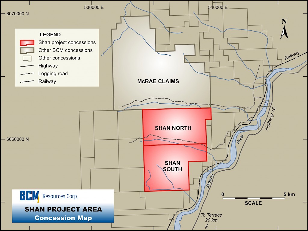
To date, the Company has increased its land holdings in the region of the original Shan South Molybdenum Discovery sixteen-fold. Since acquiring 100% of the original Shan South claims in early 2006, the Company has substantially increased its land position in the area to encompass 18,791 acres including the adjacent Shan North and McRae Claims. At Shan South, the land position surrounding the original molybdenum discovery has been increased from 1386 acres to 3933 acres.
The Shan Group of Claims Enjoy Excellent Access to Infrastructure
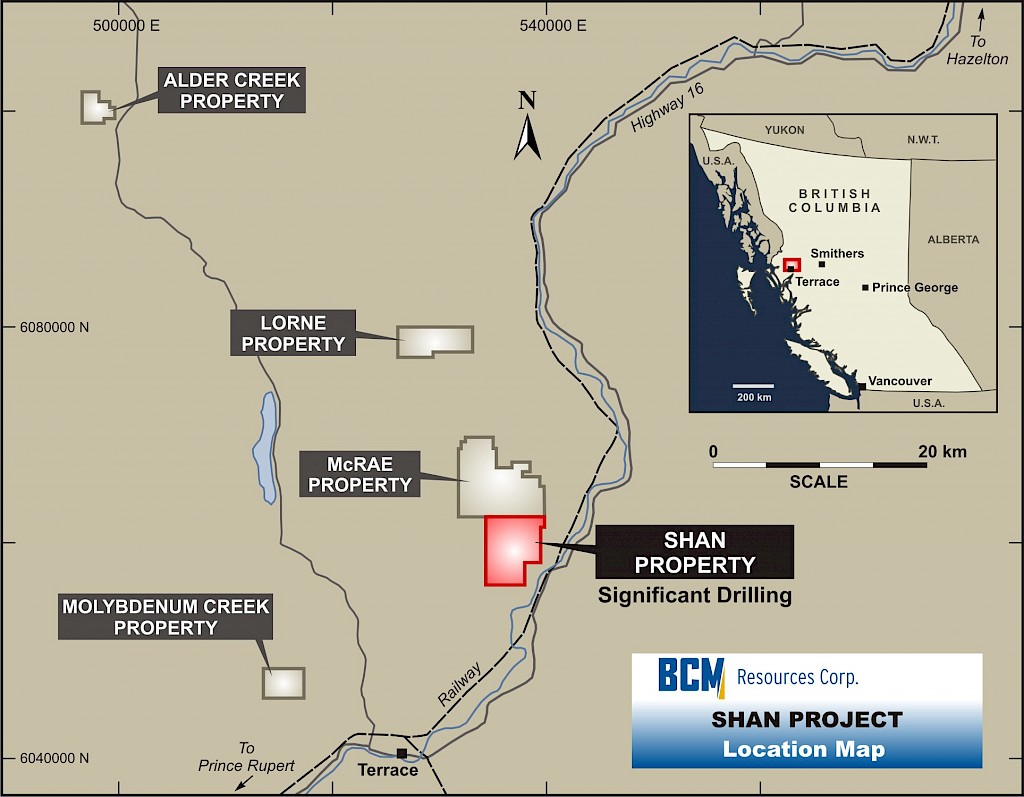
A transcontinental railroad running on the Shan side of the Skeena River leads directly to the deep water ports of Kitimat (80 km south) and Prince Rupert (163 km west). On the opposite side of the river is a main arterial highway (Highway 16), linked to the Shan claims by a bridge and network of logging roads. High powered transmission lines are within 4 km, and the community of Terrace lies 20 km to the south.
Historical Exploration
Historical data records exploration work conducted in the 1930's to 1980 as follows:
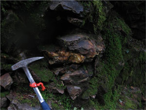
1930's: Adit dug into the side of Shan South Ridge, exploration focus on gold. Narrow quartz veins of visible molybdenum were reported and assayed showing values of up to 0.42% Mo.
1960's: Narrow-diameter, shallow holes drilled, shallow trenches dug, more indications of molybdenum.
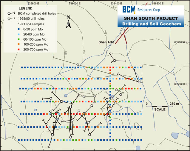
1970's: Exploration by several companies included soil surveys, limited geophysics and two diamond-drill holes. Soil survey conducted using auger obtained values commonly in the 100's of ppm Mo (up to 700 ppm)
Exploration Overview
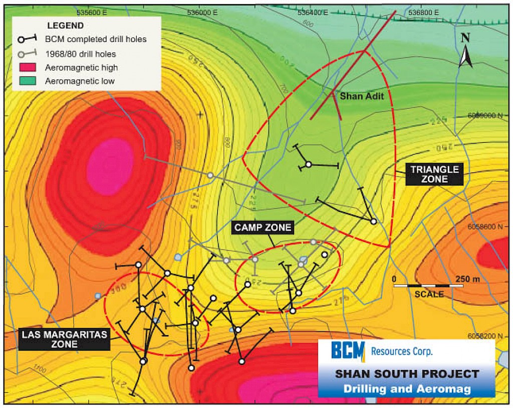
 The Company has conducted extensive exploration work since aquiring the original claims. Two helicopter supported aero-magnetic surveys have been carried out by the Company, a small survey over the original Shan South claims in 2006, with 26 Line km, 200 m spacing, followed by a larger survey in Summer 2007 encompassing the Shan South, Shan North and McRae claims, with 1110 Line km at 100 m spacing and 100 m drape. Three dimensional modeling of this data has been very useful in delineating areas of lower magnetic susceptibility that generally correspond to magnetite destruction by alteration with the potential for mineralization.
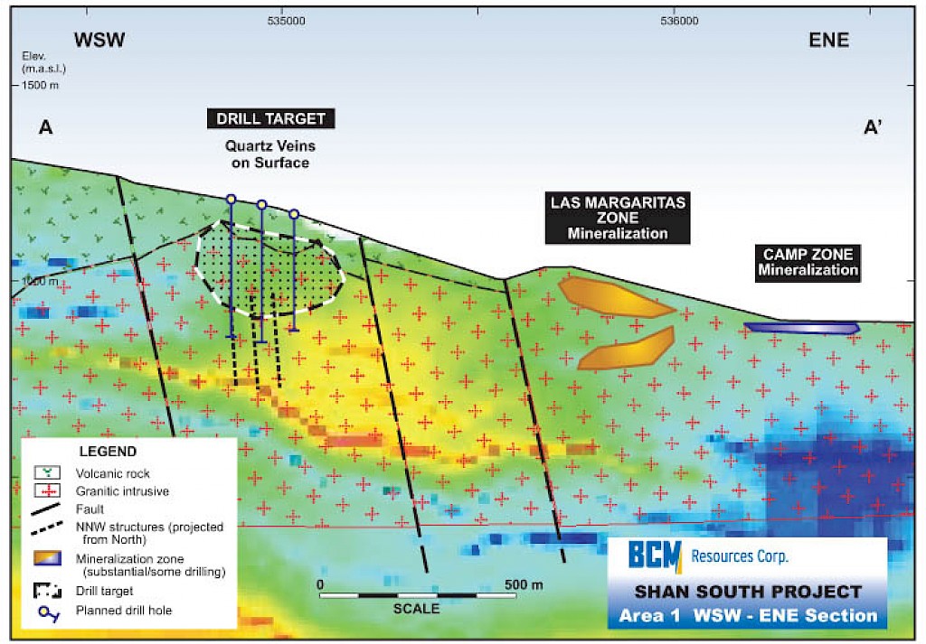
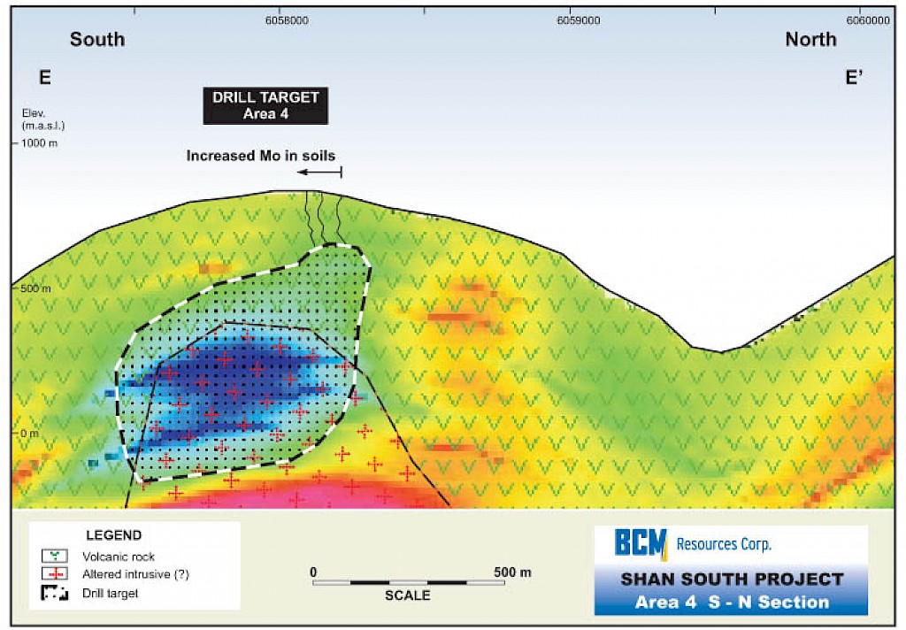
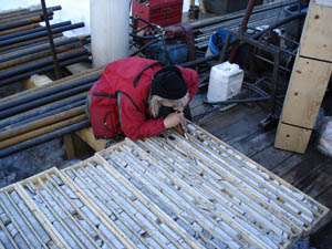
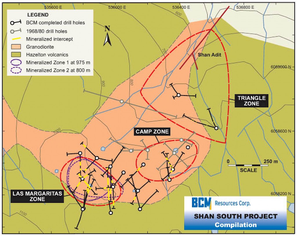
Bedrock sampling on the Shan South property identified a 1000 x 500 m NE- trending area with strong molybdenum mineralization, coinciding with the anomalous zone defined by the 1971 soil survey. Results ranged up to 0.80% Mo and commonly exceeded 0.05% Mo. Sampling and mapping of this area formed the basis for three phases of drilling completed by the Company, with 41 diamond-drill holes totalling 10,312 m.
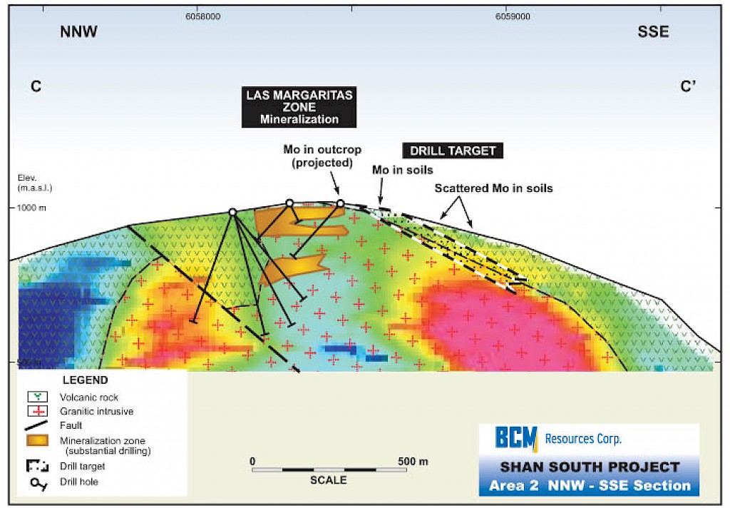
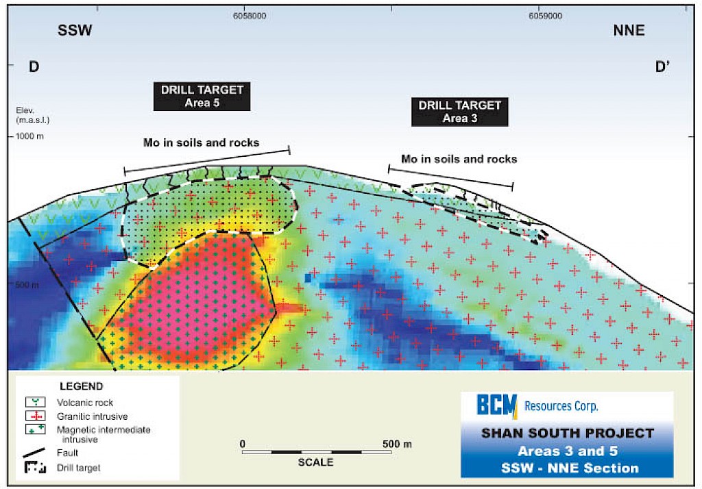
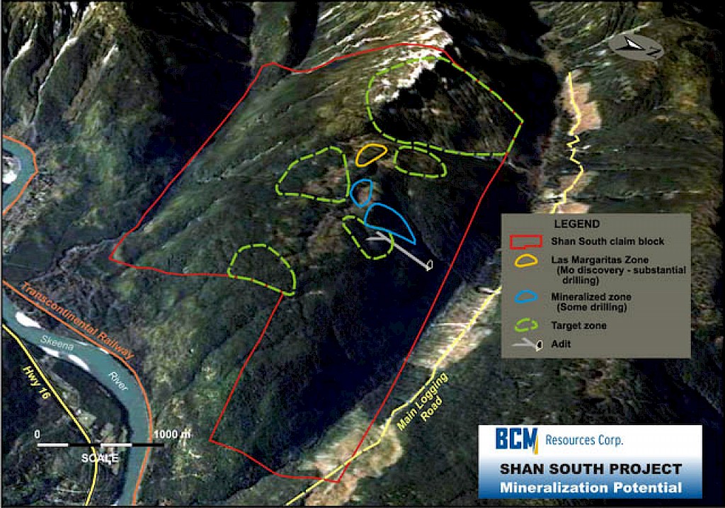
Recon mapping and soil, rock and moss mat sampling conducted during the summer 2008 field work program identified five new satellite areas located within an approximate 4 km X 2 km area with a potential for Las Margaritas style mineralization.
Diamond Drill Programs Completed at Shan South
 The Phase 1 drill program (fall 2006), consisting of 19 holes totaling 3,550 m, was designed to test near-surface mineralization. The Phase 2 drill program (spring 2007), consisting of 17 holes totaling 5,682 m, was designed to expand and deepen the coverage as well as build on the Phase 1 results.
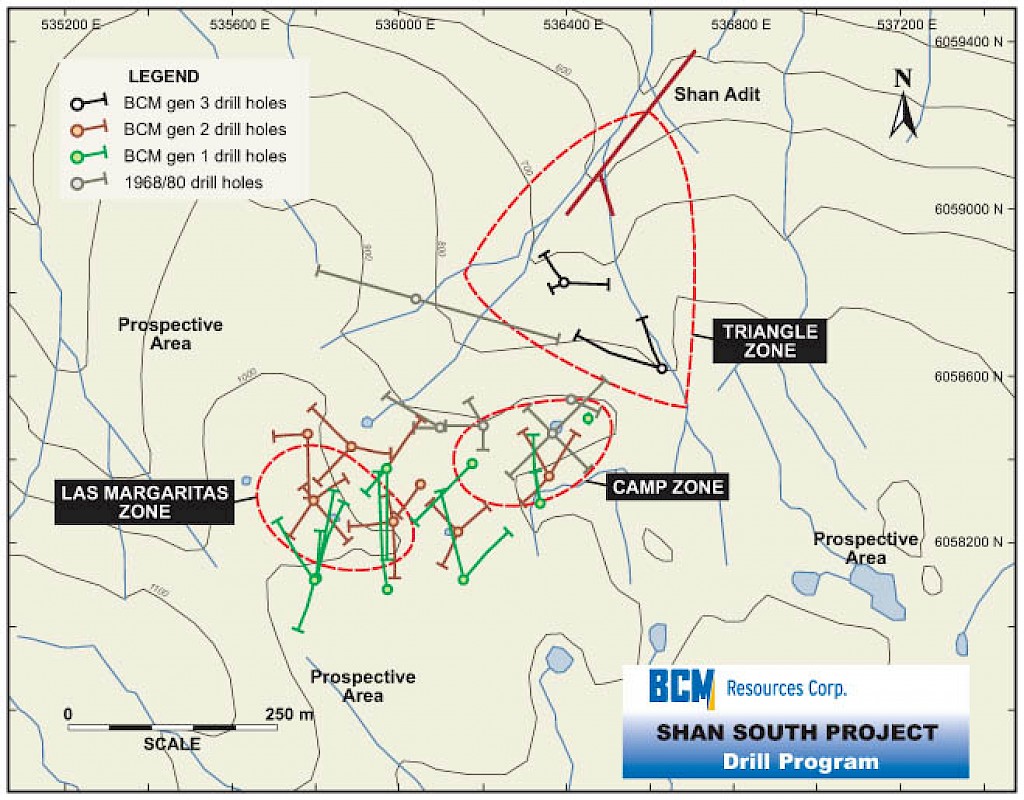
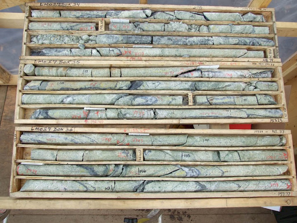
The first two programs resulted in the discovery of the Las Margaritas Zone as well as further testing the Camp Zone drilled in the 1960s. Drill core samples returned numerous significant values. Some of the better drill intercepts included 59.65 m in 0.118% Mo, including 20.8 m in 0.189% Mo in Hole 1, 122.8 m in 0.107% Mo, including 36.6 m in 0.183% Mo in Hole 7 and 190.6 m in 0.103% Mo, including 105.7 m in 0.119% Mo in Hole 27.
The Hole 27 interval included two higher grade sections grading 0.168% Mo over 26.9 m and 0.362% Mo over 14.5 m. A higher grade section encountered in the final 15 m of this hole, with an average grade of 0.152% Mo is thought to represent a feeder zone.Twenty-six of the thirty-six holes contained intervals with grades of at least 0.1% Mo and thirty-one of the holes included samples with grades of at least 0.06% Mo. All of the drill holes intersected visible molybdenum mineralization and all included intervals above 0.01% Mo.
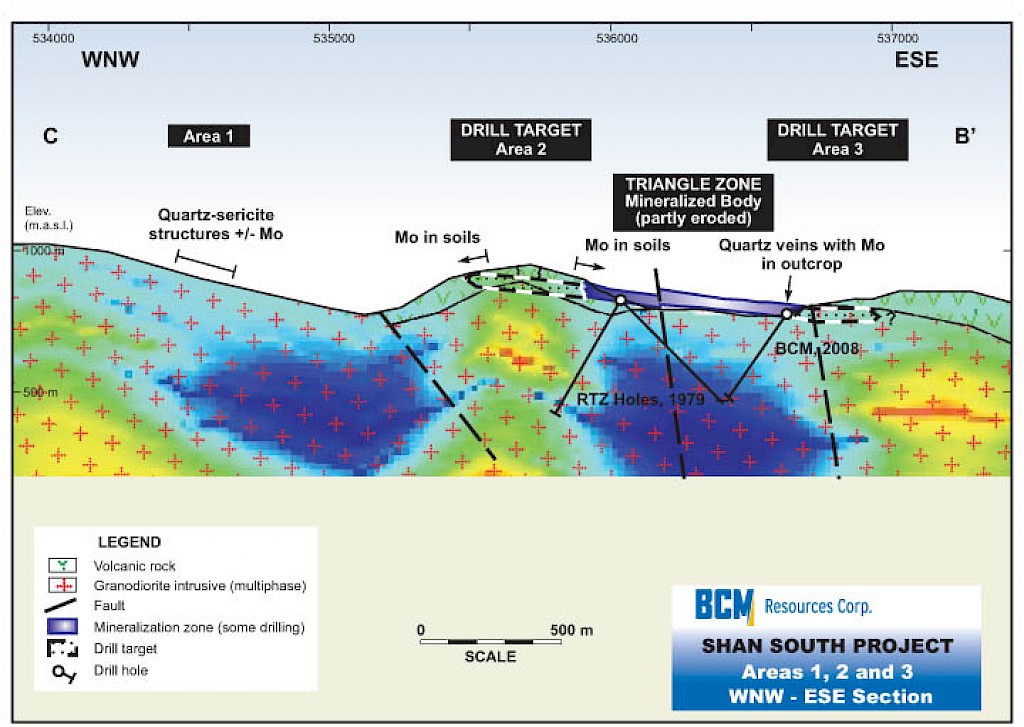
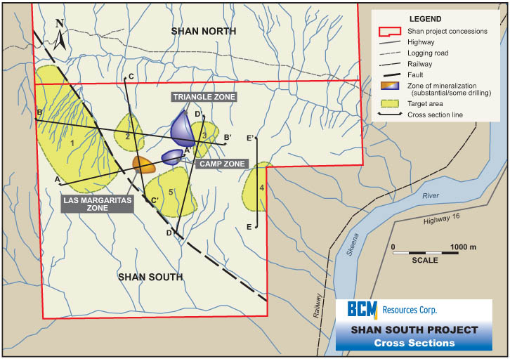
The Phase 3 drill program (fall 2008), consisting of five diamond-drill holes totalling 1080 m, tested a 500 x 500 m area north and down-slope from previous drilling. This area, referred to as the Triangle Zone, is in the vicinity of the historical adit. A pattern of scattered high-grade mineralization similar to that at the nearby Camp Zone was observed.

Diamond-Drill Program - 2011-2014
The Company applied for and received drill permits allowing for unlimited diamond-drilling at Shan South through 2014.
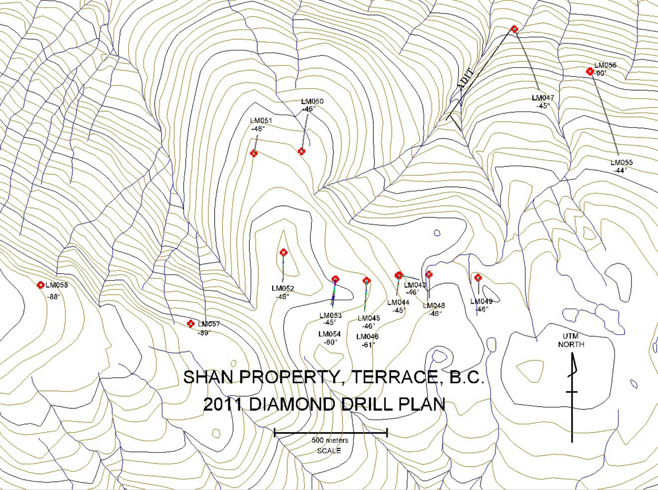
The Phase four program, completed in summer 2011, (~3500 metres of diamond-drilling) was designed to test the extent of molybdenum mineralization surrounding the Las Margaritas discovery.
Results to date further confirm the molybdenum mineralization at the Las Margaritas Zone and expand the zone eastward and westward (Please refer to Company news releases for detailed results). Significant intercepts of high-grade molybdenum mineralization were encountered throughout the Las Margaritas zone and beyond.
The Mo mineralization identified to date is open in all directions and to depth.
Significant Expansion Potential of Known Mineralized Areas at Shan South
It is the belief of the Company's geological consultants,based upon thorough and detailed analysis of all current and historical data, that the Las Margaritas, Camp and Triangle Zones may all be part of the same mineralized zone.
The Las Margaritas Zone contains the longest and highest grade drill intercept encountered to date, 190.6 m of 0.103% Mo (average grade). Las Margaritas is thought to consist of at least two levels of gently dipping mineralization with steep feeder zones. The Camp and Triangle Zones, located a few hundred meters to the NE of Las Margaritas are also believed to be gently dipping zones with high angle feeders similar to Las Margaritas. There is known molybdenum mineralization at depths of at least 250 meters below surface, as evidenced by Drill-hole 27,which bottomed in 17 m grading 0.155% Mo.
Historical assays from a 1930s underground working (the aforementioned adit) driven some 500 meters vertically below the area of recent surface drilling, returned grades of up to 0.42% Mo. The mouth of the adit is located approximately 1500 m NE of Las Margaritas, on the side of the ridge and at an elevation approximately 530 meters below. The adit extends underground, into the side of the ridge, approximately 500 metres in a southwesterly direction towards the known mineral zones .
In 2007, selected rock samples taken by the Company’s geologists from the mouth of the adit returned values up to 0.29% Mo.
Further exploration will determine the size of the mineralized system. To further test the extent and depth of molybdenum mineralization at Shan South the Company intends to aggressively drill additional exploratory holes
and to explore inside the adit in order to significantly expand and test the depth of the areas of known molybdenum mineralization.
Several promising new target zones remain to be drilled, offering significant expansion of the economic potential of this project. Five new target areas have been identified within a 2 X 4 kilometer area of known molybdenum surface mineralization through the use of geophysics combined with geochemistry. In addition to planned drilling at the Las Margaritas, Camp and Triangle zones, the Company intends to drill test these five newly identified target zones.